


You want MRV that’s scalable, validated, and cost-effective
That’s what we’ve built.
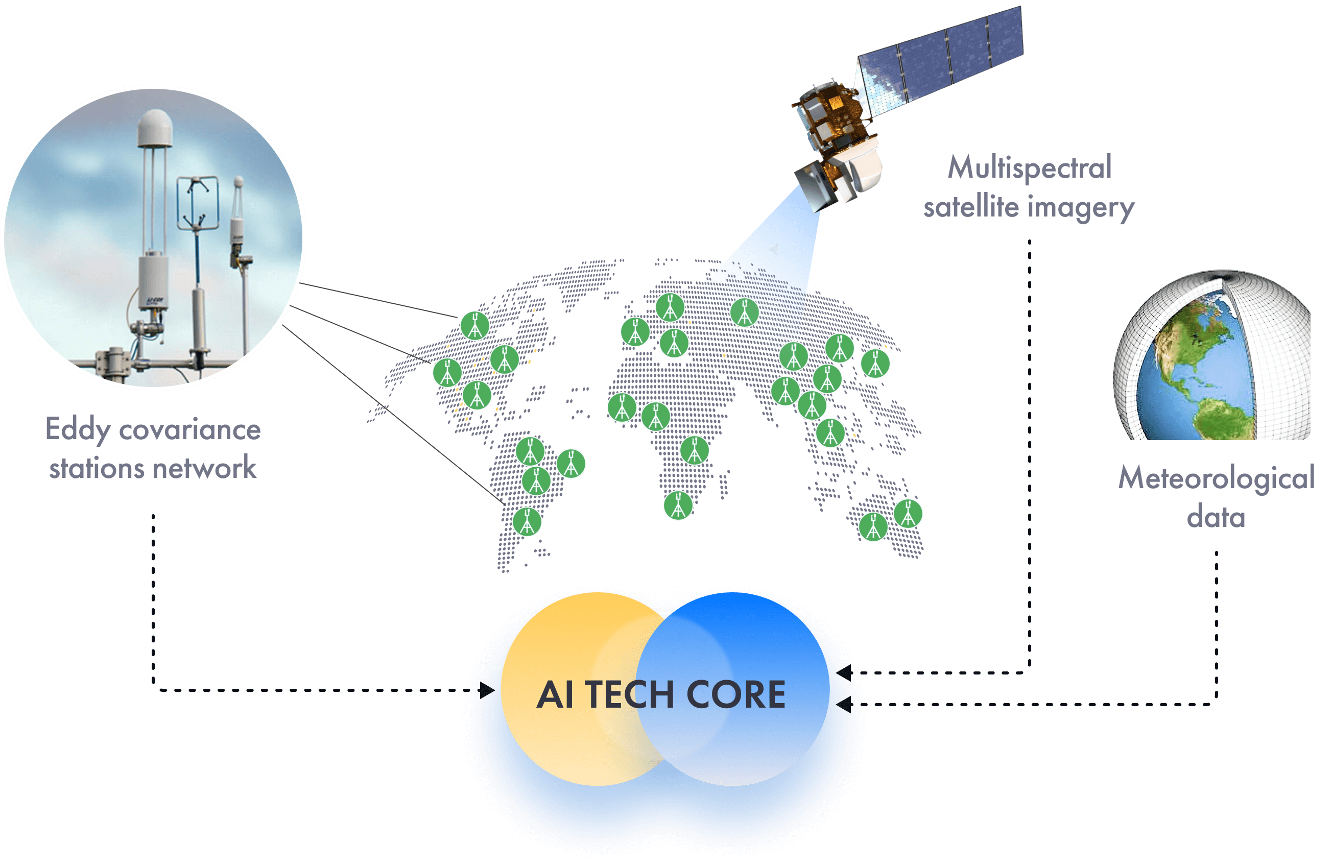
By combining satellite imagery and meteorological data with a globally distributed network of eddy covariance ground stations, CarbonSpace provides field-level carbon footprint estimates remotely for nearly any area and ecosystem on the globe.
By combining satellite imagery and meteorological data with a globally distributed network of eddy covariance ground stations, CarbonSpace provides field-level carbon footprint estimates remotely for nearly any area and ecosystem on the globe.
You want MRV that’s scalable, validated, and cost-effective
That’s what we’ve built.
By combining satellite imagery and meteorological data with a globally distributed network of eddy covariance ground stations, CarbonSpace provides field-level carbon footprint estimates remotely for nearly any area and ecosystem on the globe.
By combining satellite imagery and meteorological data with a globally distributed network of eddy covariance ground stations, CarbonSpace provides field-level carbon footprint estimates remotely for nearly any area and ecosystem on the globe.
Carbon Measurement Methods and the
CarbonSpace Hybrid MRV System
CarbonSpace Hybrid MRV System
CarbonSpace uses revolutionary machine learning algorithms that estimate carbon emissions and sequestration directly at the entire ecosystem level.


This approach is globally scalable and provides decades of historical data.

Scalable

Global coverage
Analyze any area 1 hectare or larger

Automated system requires no manual inputs
Validated
Cost-Effective
Third-party validation in accordance with ISO 14064-3 by Control Union
Primary field-level data, without the use of averages or proxies
Peer-reviewed methodology
No additional verification needed
Member of leading global scientific communities

Fully remote - no onsite operations required
Models for a range of ecosystems, including croplands, grasslands, and forests
Costs a fraction of a €/hectare at large scale

We align and collaborate with major global standards and frameworks.


The CarbonSpace technology is based on over 15 years of R&D expertise in remote carbon footprint monitoring. Our methodology is peer-reviewed and verified in accordance with ISO 14064-3.
CarbonSpace MRV unleashes nature-based carbon removal at scale. Learn more about how we can support you in reaching your goals
Food Supply Chains

Generate returns on carbon monitoring investment
Source low-carbon materials to meet sustainability goals
Communicate positive impact of initiatives in the supply chain
Nature-based Solutions
Conduct fully remote, cost-effective feasibility assessments
Measure more carbon due to lower buffer pools
Generate higher ROI due to high-quality data